Home / Survey & Mapping / Inertial Navigation Systems / Survey+
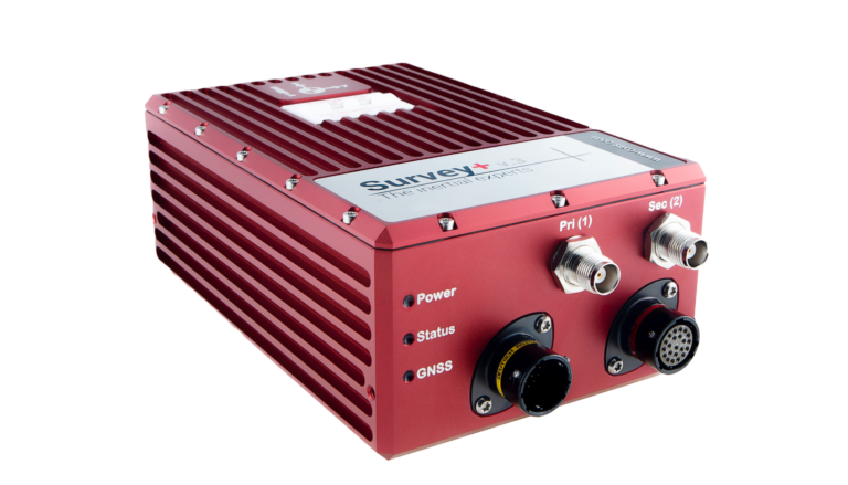
Survey+ v3
Flagship INS for land-based mobile mapping and manned aircraft mapping

0.05°
heading accuracy
0.03°
pitch / roll accuracy
0.01 m
RTK / PPK
GPS & GLONASS
Beidou & Galileo optional
Overview
Features
Applications
Resources
Overview
The Survey+ has for many years been recognised by companies worldwide as a powerful, high accuracy INS for measuring position and orientation in mobile mapping and other survey applications.
Yet it has always struck the perfect balance by continuously remaining one of the most affordable and cost-effective solutions for accurate land-based and manned aircraft mapping.
Next generation hardware and software
- A new dynamic hardware platform
- High-performance IMU sensors and GNSS receivers
- Add-on LiDAR Georeferencing software
Incredible accuracy
- Tightly-coupled processing engine gx/ix technology
- Precision positioning – the best centimetre level position accuracy
- Premium level pitch and roll performance
Flexible connectivity and integrations
- Complete “out of the box” solution – ready to seamlessly connect and use with latest 3rd party hardware and software products
- Synchronise multiple external devices – 3x Ethernet ports and 3x serial ports; capability to integrate external GNSS receivers too
- Optional Precision Time Protocol (PTP) – synchronising time with LiDAR and other sensors that also utilise the feature, allowing much simpler setup over Ethernet
Features
- Tactical-grade ITAR free IMU protects against GNSS signal dropout
- Heading accuracy not affected by magnetic disturbances
- Dual antenna GPS/GLONASS for accurate heading in all conditions
- Upgradable features designed to grow as and when needed
Supported sensor integrations with Riegl, Velodyne, Z+F, Hesai, Ouster Specim, Point Grey, Phase One and other sensors.
Comprehensive OxTS NAVsuite software package included as standard, including:
- Configuration
- Monitoring
- Post-processing
- Analysis
Event inputs and distance-based output triggers.
Optional Precision Time Protocol (PTP) time synchronisation functionality.
Applications
- Road survey
- Coastal monitoring
- Construction monitoring
- Map creation
- Geographical surveying
- Infrastructure exploration
- Building survey (BIM)
- City survey
- Forestry survey
- Rail survey
Resources